The Desert Speaks
Monumental Dunes
Season 14 Episode 1405 | 26m 14sVideo has Closed Captions
Visit three groups of sand dunes located on public land in the United States.
The arid regions of the southwestern United States contain a vast variety of dune systems. Explore a set of dunes that sit at the foot of the Rocky Mountains fenced in by two river systems. Travel to a tiny gypsum dune system at the base of the Guadalupe Mountains in west Texas. Finally, visit White Sands National Monument in New Mexico and examine ancient hearths built by Native Americans.
Problems playing video? | Closed Captioning Feedback
Problems playing video? | Closed Captioning Feedback
The Desert Speaks is presented by your local public television station.
This AZPM Original Production streams here because of viewer donations. Make a gift now and support its creation and let us know what you love about it! Even more episodes are available to stream with AZPM Passport.
The Desert Speaks
Monumental Dunes
Season 14 Episode 1405 | 26m 14sVideo has Closed Captions
The arid regions of the southwestern United States contain a vast variety of dune systems. Explore a set of dunes that sit at the foot of the Rocky Mountains fenced in by two river systems. Travel to a tiny gypsum dune system at the base of the Guadalupe Mountains in west Texas. Finally, visit White Sands National Monument in New Mexico and examine ancient hearths built by Native Americans.
Problems playing video? | Closed Captioning Feedback
How to Watch The Desert Speaks
The Desert Speaks is available to stream on pbs.org and the free PBS App, available on iPhone, Apple TV, Android TV, Android smartphones, Amazon Fire TV, Amazon Fire Tablet, Roku, Samsung Smart TV, and Vizio.
Providing Support for PBS.org
Learn Moreabout PBS online sponsorshipIt's not unusual to find sand in a desert.
Plenty of it too.
But white sand?
Or huge piles of sand with aspen growing on them?
All a part of the unexpected world of sand dunes.
Funding for the Desert Speaks was provided by Desert Program Partners.
By the Rocky Mountain Cooperative Ecosystems Studies Units.
By the Western National Parks Association.
And Carlsbad Caverns Guadalupe Mountains Association.
♪ music ♪ Most of us think of sand dunes as being found in windswept deserts or near beaches.
But some spectacular dune systems are found in most unlikely places, such as in the towering Rocky Mountains.
Perhaps the most unexpected sand dunes in North America are also located at the highest elevation, Dune Field in Great Sand Dunes National Monument is over 8,000 feet high.
My friend Yar Petryszyn and I are seeing this unusual dune field for the first time.
Well, Yar, here we have the famous dune aspens.
Yeah.
Not many places you're gonna find aspens associated with dunes but all this around us here are stabilized dunes.
Now it doesn't look like that because looking at the vegetation, because of the higher rainfall we have up here on the slope.
You didn't think there'd be a trout creek in the vicinity of a sand dunes did you?
There it is.
I wish I'd brought my fishing pole.
I like sand, frankly.
This sand really originated from snow melt.
The snow melts, freezes, melts, freezes and breaks the rock up.
And sooner or later this crashing water brings it down and what was creek sand soon becomes dune sand.
.sand dunes has got Ponderosa pines growing on it.
I know.
Isn't it amazing?
And these are big ones so this has been stabilized for awhile.
These dunes are not growing anymore and the plants are slowly moving and taking 'em over.
And taking it over.
And you see this encroachment right into the main dune field.
If you look at some of these slopes, you can see that it's covered with green.
Man, this little prickly pear here, this is kind of like a bonsai prickly pear.
Yeah, it's a dwarf prickly pear.
And of course this is a desert-adapted plant but these are tiny, full-grown but tiny.
And the reason they're so small is they have to cope with extreme cold here and also the winds.
This is a pygmy yucca.
Yeah.
And they're starting to put up a flowering head here.
These, if they were in lower elevation, would be probably over our head, tall.
Well, I would describe this as Colorado's beach.
Often people call it that.
We have lots of sand.
We don't have a lot of water but we have enough to play in and we have waves.
My, here comes a wave right here.
Well, let's see if we can follow it and see how fast it goes.
We'll walk right along with it.
People are always amazed to say, "The tallest dunes in North America and they're not on a beach and they're not out in the open, they're up here in the mountains.
How can that be?"
And yet when you start to study the area and you look at this high mountain valley and you start to study the sand, it's not beach sand.
It's sand, most of it is volcanic in nature and blows across the valley floor from the other side of the valley, from the drainages that all come down and the lower part, it just sinks.
All that sand gets there, all the gravels and sand and then it just blows by the prevailing wind.
And these mountains act like a big snow fence and keep the sand from blowing all over eastern Colorado is basically what happens here.
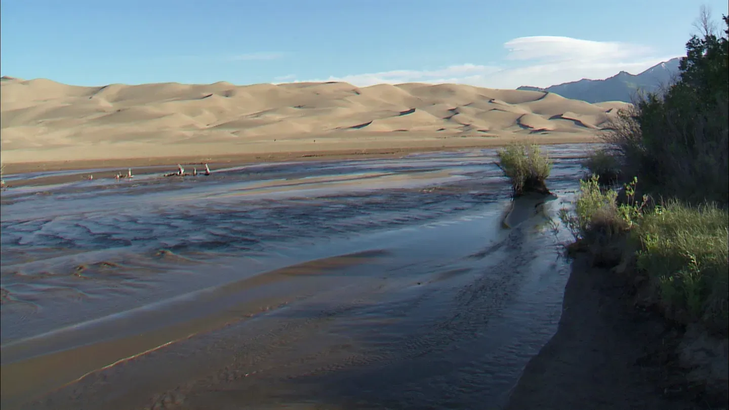
The importance of the rivers here at the Great Sand Dunes is, there's two rivers for one thing.
There's one on either side of the dunes and the rivers cradle the dune field and act as kind of a fence to keep these, the sand in place.
The sand comes down in the creeks and gets recycled, gets blown back up into the dunes.
The sand that comes off the side there, you can see it collapsing.
Is that picked up and taken out of here by the river?
It comes down here to a point and of course there, it's like a big conveyor belt of sand and it comes down and actually gets blown back up into the sand.
So it's just recycled.
That's exactly the way it would be.
The special part of the creek is this wave that you can see coming down.
That's called surge flow.
And surge flow happens only a few places naturally in the world.
And it needs three things for it to even occur at all in a natural condition.
You can see that it has to have water of course, and it has to have a really smooth surface, which of course our sand allows.
The water is flowing from a very high level from way up in the mountains and actually it's steeper than it looks as you go that direction.
And so the velocity of the creek comes down and digs the sand and actually makes little underwater dunes, which we call anti-dunes.
All of a sudden the pressure from the water breaks that anti-dune and you have this nice little wave that comes down that the kids love to ride on.
The National Park Service has used modern technology to enable the visitor to see the remarkable diversity of grains that make up the Great Sand Dunes.
From the tiny grains that come from the San Juan Mountains on the west, in a huge variety of colors and shapes, we can move across millions of years of time to see the large grains that come from the San Andre de Cristo Mountains just behind the dunes.
Those with the best view of the individual grains are those the closest to them.
Bugs.
They tend to be where there's vegetation only because there tends to be a lot of fallout from like plant feeders that make prey for predators.
This is good feedin' zone.
Yes.
Most of the insects, at least with the dunes, they tend to be what they call sand obligates, which means they only are particularly adapted for living on the sand.
They have to be tolerant of high sand temperatures.
They have to be very efficient at getting food and prey and not desiccating.
In the wintertime they tend to burrow very, very, very deeply.
They'll go three or four meters underground.
We know right now of about seven insects that are endemic to the Great Sand Dunes.
Those are the ones that are only known from the sand dunes and the surrounding habitat, the area we call the sand sheet.
For example, the Great Sand Dunes tiger beetle we only know from about 90 square miles within the dune system.
They're usually active from about the end of May until early September.
Like I said it's a very short season.
The presence of such a colorful interesting beetle in a huge sand dune brings the whole thing to life.
Right.
Like I said they call it entomology candy so it gets people hooked very easily.
That's a good phrase.
Yeah.
They're called tiger beetles because they're predators.
They have a method of seizing their prey and just ripping it to shreds is what they do.
They're very quick at it and so they're called tiger beetles mainly because of that predatory behavior.
It's not only animals that have used the dunes for finding things to eat.
Humans have known how to for hundreds of years.
This is one of these trees here that we call a culturally peeled or scarred tree.
So that's not natural?
No, no.
This was done, I believe through coring we found that it was peeled in 1836 most likely by the Utes to utilize as a food source.
Well, that is remarkable.
We used to think they would do it in times of starvation but with consultation with native peoples, realizing it was most likely at a time when it was wetter and the bark had more fluid in it, it was richer.
From the stories I've been told there was an outing where women and children would go out and peel bark off the trees and collect it.
It has kind of a sweet flavor to it.
It has a high level of calcium and fiber and so it's probably a very good food source.
We have 72 scarred trees and there's 88 scars.
So several trees are scarred two and even three times.
These trees are very important.
They are on the national register of historic places.
It's one of the few properties that I know of that's not a structure, that is just a stand of trees that were utilized by native peoples.
So they're living artifacts.
The Great Sand Dunes are large enough to provide for many plants, animals, and people.
Another dune system is much more limited.
I hadn't even heard of the one in a remote section of Guadalupe Mountains National Park in west Texas.
Don't blink as you hike by.
When you look at a dune and you have a little curiosity, you always ask yourself, "What is this dune made of?
Where did that come from?
How did it get here?"
And finally, "Why is it right here and not else?"
Then we begin to understand what the dunes are all about.
The tiny Guadalupe Dunes didn't come from crumbly mountains but from an entirely different source.
Gypsum dunes themselves don't occur just anywhere.
They're always associated with some evaporite deposit, some sort of lake situation in a dry environment.
And it requires a lack of vegetation cover as well as the evaporations in the lake to produce areas like this.
There's a whole series of playa lakes out here.
Very shallow, flat lakes with a lot of wind blowing across them.
Adds water with minerals, percolates up from underneath, it crystallizes on the surface and then the wind blows those crystals in the downwind direction.
And this seems to be the area where they accumulate.
These gypsum dunes right in here are about twelve to fifteen hundred years old.
That date was established using plant fragments that were buried in the migrating dunes.
The grains of sand that make up the Gypsum Dunes aren't round as they are in most other dunes, they're angular.
Square, rectangular, odd shapes and they adhere to each other, which means that when you get to the edge of a dune, they're pulling so tight together that they'll create almost a cliff face.
Yar is able to find signs of life anywhere.
Even in the Gypsum Dunes.
.and you can see where it chews this webbing to line it's hole to keep the sand from collapsing the hole and that's probably used as a trap door to close this during the heat of the day.
And you can see where the spider last night was foraging around, you can see these little tracks here, looking for something to eat.
Although this is the off season for the majority of the rains, we got some rains and there's some flowers blooming.
And this is a real common one here.
Oh, you see these mustards.
Yeah.
It's called pepper grass.
Here it is March and we see some wildflowers that have taken advantage of that and they're actually blooming.
As you chew, you get a little more bite with each chew.
And then it comes on real strong.
It's hotter than a lot of horseradish.
Now these wildflowers will produce a profusion of seeds that are distributed throughout the environment.
And they can sit in the soil for years waiting for the optimum time of rains and temperature for them to produce another plant and flowers.
You notice several different species of wildflowers.
There's the spectacle pod, wild mustard that has the unique seed, has two halves to it that look like spectacles or eyeglasses.
Sand verbena is another common one that's blooming right now.
And they prefer the real sandy soils.
There's a small daisy that's only a couple of inches tall.
The plants in this area provide great food resource for the animals here but they also provided food resource for the indigenous people.
And mesquite is one of them that was very, very important.
Even if it's ugly mesquite like this.
Yeah, well this hasn't leafed out yet and it's really stunted.
In other areas they get more moisture, the mesquites could be, you know, 20 foot tall.
These dunes are small but were still a major impediment to the forerunner to today's freeways, the Butterfield Stage Route.
It seems hard to believe that 150 years ago stage coaches were coming through here and this is pretty tough desert to take a stage through.
Yeah, it is.
They had to not only negotiate the loose materials at this point but they also had to be sure that they could get from water point to water point, from the last water soure up on the top of the mountain at Pine Springs.
That's in the park now.
.that's in the park, on up to the Crow Flat Springs.
It was probably 12-15 mile trek across a lot of loose material like this.
Can you imagine what it would be like riding over this country in that coach.
You must have gotten black and blue by the time you finished that trip.
How long did it take to make a crossing?
It was usually about 21 days, 1500 miles.
Oh, man.
They had stations every 20 miles to change horses because it was so hard on the horses.
I guess they didn't consider how many stations the people needed.
You're right.
They probably needed it worse than the horses did.
The Butterfield Stage Route required weigh places, houses, every 20 miles or more than 70 in total in the nearly 1500 miles.
These were not just little stops, they were elaborate buildings with plenty of space for the cooks, the blacksmiths, the muleteers.
It was a logistically very difficult job to do and it lasted all of 11 months.
The compact dune system and stage route are just a part of Guadalupe Mountains National Park.
The Guadalupe Mountains are the highest point in Texas.
The high point in Guadalupe Peak is over 8,700 feet.
It's not very high by western state standards but it's a big mountain, it's a dramatic mountain, somethin' Texans can be proud of.
When the state of Texas was formed, all the land was privately owned for a variety of reasons.
So when this park was established, it had to be purchased from the rancher than ran it.
The reason this park was established is because there was a local interest that wanted to see this area preserved, Wallace Pratt being strongly one of the founders.
It's one of the few places in Texas and in this area where people can come and easily get into some really, really great wilderness and see nothing else but the dunes and this great backdrop and the great wide open expanse that's west Texas.
I sometimes joke when I tell people about living out here in west Texas and those sand dunes and this mountain range and I said, "You know, it's not the end of the earth, but you can see it from here."
Just north across the state line is a more serious and better known dune field.
Wherever you have big sand dunes, you have big wind.
At White Sands they've got plenty of wind.
So, the Park Service has erected these ingenious little shelters the parabolic shades here protect not so much against the sun as against the sand blown in by the wind.
Gypsum dune fields are very rare.
There's only a handful in the world and this is the only one of any appreciable size, 275 square miles of Gypsum dunes.
The dune field is sort of a hole in the donut and we're completely surrounded by military land.
The sand comes from a dry lake bed, an ephemeral lake called Lake Lucero, the remnant of an ice age lake that used to be here during the last ice age.
It covered a good part of the Tularosa Basin.
It's southwest of the main dune field and in it Lake Lucero gypsum crystals are created, which eventually break down into small enough particles to be moved by the wind and over the last several thousand years have moved them about half way across the Tularosa Basin.
Sand can be any material but most sand, sand dunes are made out of quartz sand which is quite hard and durable.
Gypsum sand is much softer, it breaks down much more easily and eventually can break down into dust and be blown away and moved outside the dune field.
.swirling certain tracks in here.
It's just sinewy ridges formed by the winds itself.
It's absolutely natural.
Yes.
This is a true desert inherent environment.
Our average rainfall is about ten inches a year here, mostly in the summertime.
Extreme fluctuations in temperature.
It could be well over a hundred degrees in the summer and most nights in the winter are below freezing.
Gypsum for the dunes comes from Lake Lucero.
Where did it come from to get into Lake Lucero itself?
Well, the ultimate source of the gypsum is from rock layers in the surrounding mountains from the Permium Geologic Age.
Gypsum being soluble dissolves every time the rainfall flows into it or snowmelt and then is carried down very quickly into the basin by moving water.
So the dunes really are recycled strata from the mountains.
Does that make sense?
Absolutely.
Yes.
The little valleys between the dunes are called swales or inter-dune valleys.
This one's about 300 feet wide.
It's full of grasses and yuccas and a few small shrubs.
But this dune is moving about 30 feet a year and so in another ten years all of this will be full of dune.
This valley is doomed.
But this is, this is not a live root.
No, it's actually a fossil of a root.
But what has happened here is that the gypsum may have actually replaced root material once it decomposed or dissolved gypsum filled the cavity that it would be in and so this could be a cast of the root itself.
The human past in White Sands National Monument is harder to find but it's still evident with a little help.
This area was inhabited by the Mogollon from approximately 1700 years ago up to about 500 or 600 years ago.
They would have come here because there were natural resources like grasses and succulents and animals, basically for food.
What are we seeing here?
Well, this appears to be the remnants of a hearth or a campfire.
A lot of sites only have two or three hearths which would suggest that it was a small group.
It could have been families, extended families.
This is a fragment of a hearth.
And if you look at it this would have been the top of the hearth and this the bottom of the hearth.
A lot of them will be pieces of charcoal, little sticks, little pieces of animal bone.
They were probably here actually on the site for short periods of time gathering plants and then they would leave and go back to their residences, which was probably more towards the mountains.
Hearths form when you build a fire in the gypsum, which changes it to plaster of paris and then when it rains on it, it hardens.
I'm sure this particular hearth is, it's very ashy and dark.
The reason that they're pedestalled is because the sand has eroded around the hearth, which is harder and holds the sand underneath it to gather but everything else around it blows away.
Evidence of the human past endures much longer than the signs of animals.
Those traces are blown away each day.
Here's one of the little pocket mice from the dune area.
Well adapted for dunes.
They have hairs on their toes that they can, when they spread their toes they can keep from sinking in sand.
And this little guy has external cheek pouches.
That way they can store any seeds that they find and put them in their pouch and keep their mouth closed the whole time.
That way they won't loose any moisture.
And then once they get their pouches full then they'll go down in the burrow and spend the rest of the day avoiding the sun during the heat of the day.
So they come out at night typically to forage for seeds.
This formation is called a pedestal From here it looks like a human head with a hairpiece on top of it.
The mode is here because the wind comes blasting in here and is tearing all of the gypsum sand from around the base.
This is pretty hard but don't think it's gonna last.
There's another dune coming and as the wind gets a little higher, it's gonna tear this thing apart.
And 50 years from now it'll be gone.
The variety of sand dune systems seems to be unending.
Some are so small you could almost throw a baseball over them.
Some are so vast that it takes days to get across them.
But from the infinitesimally small grains to the ever-changing mountains of sand, each has its own story and personality.
To most people the stereotypical image of a desert usually includes lots of sand, though not necessarily pink, with tenacious critters and a few plants and little else.
Today, that picture isn't complete without the addition of people and their toys.
Next time on the Desert Speaks.
♪ music ♪ Funding for the Desert Speaks was provided by Desert Program Partners.
By the Rocky Mountain Cooperative Ecosystems Studies Units.
By the Western National Parks Association.
And Carlsbad Caverns Guadalupe Mountains Association.


Support for PBS provided by:
The Desert Speaks is presented by your local public television station.
This AZPM Original Production streams here because of viewer donations. Make a gift now and support its creation and let us know what you love about it! Even more episodes are available to stream with AZPM Passport.